
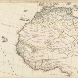
L'Afrique divisée en ses Empires, Royaumes, et Républiques...
Permalink
https://digital.library.illinois.edu/items/29bf8390-e946-0133-1d3d-0050569601ca-6
This item is in the public domain.
Descriptive Information
| Title | L'Afrique divisée en ses Empires, Royaumes, et Républiques... |
| Creator | Robert de Vaugondy, Didier, 1723-1786 |
| Date | 1767-1784 |
| Dimensions | 49 x 56 cm |
| Place of Publication | Paris (France) |
| Cartographic Scale | 1:8,600,000 |
| Notes | One of four sheets. |
| Coverage-Spatial | Africa, West |
| Genre | Maps |
| Language | French |
| Physical Location | Professor Thomas Bassett Personal Collection |
| Bibliography | Tooley 95 |
| Map ID | afm0003120 |
| Rights | No Copyright - United States |
| Rights Description | This item is in the public domain. |
| Collection Title | Maps of Africa to 1900 |
| Repository | Rare Book & Manuscript Library |
| Type | Cartographic material |
| Collection | Maps of Africa to 1900 |
Download Options
|
L'Afrique divisée en ses Empires, Royaumes, et Républiques... |
Contact us
for questions and to provide feedback.