
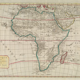
L'Afrique divisée en ses Principaux Etats
Permalink
https://digital.library.illinois.edu/items/29ce5b50-e946-0133-1d3d-0050569601ca-d
This item is in the public domain.
Descriptive Information
| Title | L'Afrique divisée en ses Principaux Etats |
| Creator | Janvier, Jean Denis |
| Date | 1762 |
| Dimensions | 30 x 43 cm |
| Cartographic Scale | 1:25,000,000 |
| Coverage-Spatial | Africa |
| Genre | Maps |
| Language | French |
| Physical Location | Professor Thomas Bassett Personal Collection |
| Map ID | afm0003119 |
| Rights | No Copyright - United States |
| Rights Description | This item is in the public domain. |
| Collection Title | Maps of Africa to 1900 |
| Repository | Rare Book & Manuscript Library |
| Type | Cartographic material |
| Collection | Maps of Africa to 1900 |
Download Options
|
L'Afrique divisée en ses Principaux Etats |
Contact us
for questions and to provide feedback.