
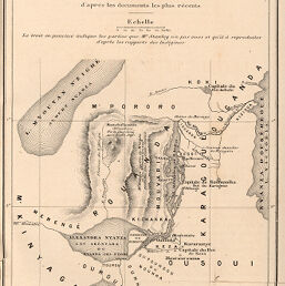
Carte du Nil Alexandra et de L’Alexandra Nyanza
Permalink
https://digital.library.illinois.edu/items/2a0789d0-e946-0133-1d3d-0050569601ca-f
This item is in the public domain.
Descriptive Information
| Title | Carte du Nil Alexandra et de L’Alexandra Nyanza |
| Creator | Hausermann, R., active 1875-1915 |
| Date | 1877 |
| Dimensions | 21.3 x 14 cm |
| Place of Publication | Italy |
| Cartographic Scale | 1:2,500,000 |
| Coverage-Spatial | Africa, Eastern |
| Genre | Maps |
| Language | French |
| Color | Bitonal |
| Technique | Lithography |
| Source | Bollettino della Società geografica italiana, ser. 2, V. 2, between pp. 246-247. |
| Physical Location | stx |
| Map No. in Bassett and Scheven Bibliography | 1187 |
| Call Number | 910_6SORSER_2 |
| Map ID | afm0001187 |
| Rights | No Copyright - United States |
| Rights Description | This item is in the public domain. |
| Collection Title | Maps of Africa to 1900 |
| Repository | Rare Book & Manuscript Library |
| Type | Cartographic material |
| Collection | Maps of Africa to 1900 |
Download Options
|
Carte du Nil Alexandra et de L’Alexandra Nyanza |
Contact us
for questions and to provide feedback.