
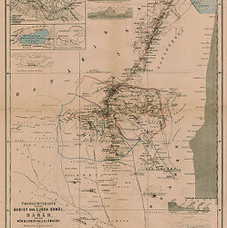
Übersichtskarte von dem Gebiet der Ejssa-Somâl, von Harar und den Nördlichen Gallaländern
Permalink
https://digital.library.illinois.edu/items/2a4ae020-e946-0133-1d3d-0050569601ca-c
This item is in the public domain.
Descriptive Information
| Title | Übersichtskarte von dem Gebiet der Ejssa-Somâl, von Harar und den Nördlichen Gallaländern |
| Creator | Paulitschke, Philipp, 1854-1899 |
| Date | 1885 |
| Dimensions | 47.7 x 35.3 cm |
| Place of Publication | Germany |
| Cartographic Scale | 1:1,000,000 |
| Notes | Includes 10 elevation profiles and cross sections and 3 inset maps: Plan-Skizze von Harar (scale 1:16,000) -- [Haramaja See] -- Plan der Ruinen von Bia Woraba. |
| Coverage-Spatial | Djibouti |
| Subject | |
| Genre | Maps |
| Language | German |
| Color | Printed color |
| Source | Petermanns geographische Mitteilungen, V. 31, plate 17. |
| Physical Location | stx |
| Map No. in Bassett and Scheven Bibliography | 1279 |
| Call Number | Q_910_5PE |
| Map ID | afm0001279 |
| Rights | No Copyright - United States |
| Rights Description | This item is in the public domain. |
| Collection Title | Maps of Africa to 1900 |
| Repository | Rare Book & Manuscript Library |
| Type | Cartographic material |
| Collection | Maps of Africa to 1900 |
Download Options
|
Übersichtskarte von dem Gebiet der Ejssa-Somâl, von Harar und den Nördlichen Gallaländern |
Contact us
for questions and to provide feedback.