
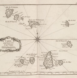
Carte des Isles du Cap Verd
Permalink
https://digital.library.illinois.edu/items/2aaaa8c0-e946-0133-1d3d-0050569601ca-f
This item is in the public domain.
Descriptive Information
| Title | Carte des Isles du Cap Verd |
| Creator | Bellin, Jacques Nicolas |
| Date | 1764 |
| Dimensions | 21.2 x 29 cm |
| Cartographic Scale | 1:1,600,000 |
| Coverage-Spatial | Islands--Africa |
| Genre | Maps |
| Language | French |
| Color | Bitonal |
| Technique | Etched or engraved |
| Source | Petit atlas, V. 3, plate 100. |
| Physical Location | ihlc |
| Map No. in Bassett and Scheven Bibliography | 2405 |
| Call Number | Q_912B41P |
| Map ID | afm0002405 |
| Rights | No Copyright - United States |
| Rights Description | This item is in the public domain. |
| Collection Title | Maps of Africa to 1900 |
| Repository | Rare Book & Manuscript Library |
| Type | Cartographic material |
| Collection | Maps of Africa to 1900 |
Download Options
|
Carte des Isles du Cap Verd |
Contact us
for questions and to provide feedback.