
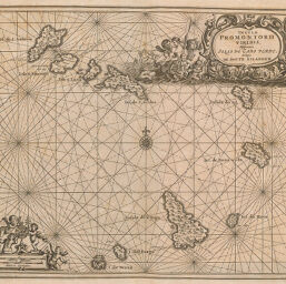
Insulae Promontorii Viridis, Hispanis Islas de Cabo Verde Belgis de Soute Eylanden
Permalink
https://digital.library.illinois.edu/items/2ab9f2d0-e946-0133-1d3d-0050569601ca-7
This item is in the public domain.
Descriptive Information
| Title | Insulae Promontorii Viridis, Hispanis Islas de Cabo Verde Belgis de Soute Eylanden |
| Creator | Ogilby, John, 1600-1676 |
| Date | 1670 |
| Dimensions | 24.8 x 31 cm |
| Cartographic Scale | 1:1,480,000 |
| Coverage-Spatial | Islands--Africa |
| Genre | Maps |
| Language | Latin |
| Source | Africa, p. 729. |
| Physical Location | rbx |
| Map No. in Bassett and Scheven Bibliography | 2394 |
| Call Number | XQ_916OG4A |
| Map ID | afm0002394 |
| Rights | No Copyright - United States |
| Rights Description | This item is in the public domain. |
| Collection Title | Maps of Africa to 1900 |
| Repository | Rare Book & Manuscript Library |
| Type | Cartographic material |
| Collection | Maps of Africa to 1900 |
Download Options
|
Insulae Promontorii Viridis, Hispanis Islas de Cabo Verde Belgis de Soute Eylanden |
Contact us
for questions and to provide feedback.