
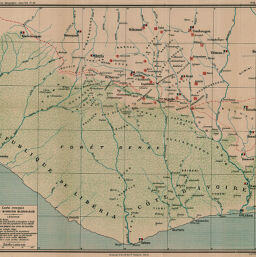
Carte croquis de la Mission Blondiaux
Permalink
https://digital.library.illinois.edu/items/2aca62b0-e946-0133-1d3d-0050569601ca-f
This item is in the public domain.
Descriptive Information
| Title | Carte croquis de la Mission Blondiaux |
| Creator | Eysséric, J. |
| Date | 1899 |
| Dimensions | 36.6 x 32.1 cm |
| Place of Publication | France |
| Cartographic Scale | 1:2,000,000 |
| Notes | Map indicates villages with round huts, square huts, forest people, or Muslim influence. |
| Coverage-Spatial | French West Africa |
| Subject | |
| Genre | Maps |
| Language | French |
| Color | Printed color |
| Source | Annales de géographie : bulletin de la Société de géographie, V. 8, between pp. 288-289. |
| Physical Location | stx |
| Map No. in Bassett and Scheven Bibliography | 2388 |
| Call Number | 910_5AN |
| Map ID | afm0002388 |
| Rights | No Copyright - United States |
| Rights Description | This item is in the public domain. |
| Collection Title | Maps of Africa to 1900 |
| Repository | Rare Book & Manuscript Library |
| Type | Cartographic material |
| Collection | Maps of Africa to 1900 |
Download Options
|
Carte croquis de la Mission Blondiaux |
Contact us
for questions and to provide feedback.