
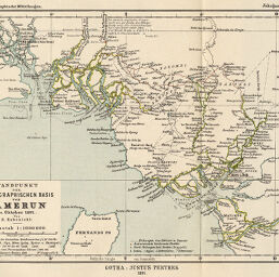
Standpunkt der Kartographischen Basis vom Kamerun im Oktober 1891
Permalink
https://digital.library.illinois.edu/items/2b38b620-e946-0133-1d3d-0050569601ca-6
This item is in the public domain.
Descriptive Information
| Title | Standpunkt der Kartographischen Basis vom Kamerun im Oktober 1891 |
| Creator | Habenicht, Hermann, 1844-1917 |
| Date | 1891 |
| Dimensions | 18.7 x 25.5 cm |
| Place of Publication | Germany |
| Cartographic Scale | 1:1,000,000 |
| Coverage-Spatial | Cameroon |
| Subject | |
| Genre | Maps |
| Language | German |
| Color | Printed color |
| Technique | Lithography |
| Source | Petermanns geographische Mitteilungen, V. 37, plate 20. |
| Physical Location | stx |
| Map No. in Bassett and Scheven Bibliography | 2314 |
| Call Number | Q_910_5PE |
| Map ID | afm0002314 |
| Rights | No Copyright - United States |
| Rights Description | This item is in the public domain. |
| Collection Title | Maps of Africa to 1900 |
| Repository | Rare Book & Manuscript Library |
| Type | Cartographic material |
| Collection | Maps of Africa to 1900 |
Download Options
|
Standpunkt der Kartographischen Basis vom Kamerun im Oktober 1891 |
Contact us
for questions and to provide feedback.