
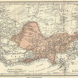
Karte de Niger-Gebiets
Permalink
https://digital.library.illinois.edu/items/2bcde910-e946-0133-1d3d-0050569601ca-a
This item is in the public domain.
Descriptive Information
| Title | Karte de Niger-Gebiets |
| Creator | Perthes, Justus |
| Date | 1880 |
| Dimensions | 21 x 37.8 cm |
| Place of Publication | Germany |
| Cartographic Scale | 1:12,500,000 |
| Notes | Relief shown by hachures and spot heights. |
| Coverage-Spatial | Niger |
| Subject | |
| Genre | Maps |
| Language | German |
| Color | Printed color |
| Technique | Lithography |
| Source | Mitteilungen der Geographischen Gesellschaft in Hamburg, V. 4, after p. 97. |
| Physical Location | stx |
| Map No. in Bassett and Scheven Bibliography | 2252 |
| Call Number | 910_6GEO |
| Map ID | afm0002252 |
| Rights | No Copyright - United States |
| Rights Description | This item is in the public domain. |
| Collection Title | Maps of Africa to 1900 |
| Repository | Rare Book & Manuscript Library |
| Type | Cartographic material |
| Collection | Maps of Africa to 1900 |
Download Options
|
Karte de Niger-Gebiets |
Contact us
for questions and to provide feedback.