
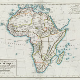
Carte Générale et Politique de Afrique
Permalink
https://digital.library.illinois.edu/items/2bdcdaf0-e946-0133-1d3d-0050569601ca-c
This item is in the public domain.
Descriptive Information
| Title | Carte Générale et Politique de Afrique |
| Creator | Chanlaire, P.-G. (Pierre-Grégoire), 1758-1817 |
| Date | 1807 |
| Dimensions | 31.8 x 41.3 cm |
| Place of Publication | France |
| Cartographic Scale | 1:29,550,000 |
| Coverage-Spatial | Africa |
| Genre | Maps |
| Language | French |
| Source | Atlas universel, plate 165. |
| Physical Location | rbx, max-stos |
| Map No. in Bassett and Scheven Bibliography | 143 |
| Call Number | XF_912M52A |
| Map ID | afm0000143 |
| Rights | No Copyright - United States |
| Rights Description | This item is in the public domain. |
| Collection Title | Maps of Africa to 1900 |
| Repository | Rare Book & Manuscript Library |
| Type | Cartographic material |
| Collection | Maps of Africa to 1900 |
Download Options
|
Carte Générale et Politique de Afrique |
Contact us
for questions and to provide feedback.