
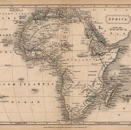
Africa
Permalink
https://digital.library.illinois.edu/items/2c4db060-e946-0133-1d3d-0050569601ca-1
This item is in the public domain.
Descriptive Information
| Title | Africa |
| Creator | Butler, Samuel, 1774-1839 |
| Date | 1840 |
| Dimensions | 18.8 x 23.8 cm |
| Place of Publication | England |
| Cartographic Scale | 1:46,500,000 |
| Coverage-Spatial | Africa |
| Genre | Maps |
| Color | Hand colored |
| Technique | Etched or engraved |
| Source | Atlas of Modern Geography, plate 28. |
| Physical Location | mar |
| Map No. in Bassett and Scheven Bibliography | 195 |
| Call Number | 912B97A |
| Map ID | afm0000195 |
| Rights | No Copyright - United States |
| Rights Description | This item is in the public domain. |
| Collection Title | Maps of Africa to 1900 |
| Repository | Rare Book & Manuscript Library |
| Type | Cartographic material |
| Collection | Maps of Africa to 1900 |
Download Options
Contact us
for questions and to provide feedback.