
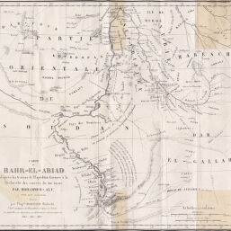
Carte du Bahr-El-Abiad d'après les travaux de l'Expédition Envoyée à la Recherche des sources du Nil Blanc Par Mahammed-Aly...
Permalink
https://digital.library.illinois.edu/items/2c5c8270-e946-0133-1d3d-0050569601ca-0
This item is in the public domain.
Descriptive Information
| Title | Carte du Bahr-El-Abiad d'après les travaux de l'Expédition Envoyée à la Recherche des sources du Nil Blanc Par Mahammed-Aly... |
| Creator | Société de Géographie (France) |
| Date | 1843 |
| Dimensions | 30.6 x 33.5 cm |
| Place of Publication | France |
| Cartographic Scale | 1:5,000,000 |
| Notes | Relief shown by hachures. |
| Coverage-Spatial | White Nile (Sudan) |
| Subject | |
| Genre | Maps |
| Language | French |
| Color | Bitonal |
| Technique | Lithography |
| Source | Bulletin, Société de géographie, ser. 2, V. 19, after p. 176. |
| Physical Location | stx |
| Map No. in Bassett and Scheven Bibliography | 200 |
| Call Number | 910_6 SOGEASER_2 |
| Map ID | afm0000200 |
| Rights | No Copyright - United States |
| Rights Description | This item is in the public domain. |
| Collection Title | Maps of Africa to 1900 |
| Repository | Rare Book & Manuscript Library |
| Type | Cartographic material |
| Collection | Maps of Africa to 1900 |
Download Options
|
Carte du Bahr-El-Abiad d'après les travaux de l'Expédition Envoyée à la Recherche des sources du Nil Blanc Par Mahammed-Aly... |
Contact us
for questions and to provide feedback.