
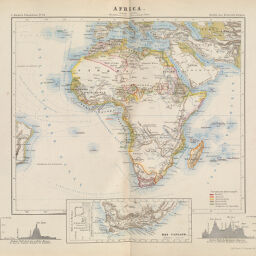
Africa
Permalink
https://digital.library.illinois.edu/items/2c79d600-e946-0133-1d3d-0050569601ca-e
This item is in the public domain.
Descriptive Information
| Title | Africa |
| Creator | Adami, C. |
| Date | 1855 |
| Dimensions | 22.3 x 26.7 cm |
| Place of Publication | Germany |
| Cartographic Scale | 1:47,320,000 |
| Coverage-Spatial | Africa |
| Genre | Maps |
| Color | Printed and hand colored |
| Source | Schul-Atlas, plate 18. |
| Physical Location | maos |
| Map No. in Bassett and Scheven Bibliography | 218 |
| Call Number | Q_912AD1S |
| Map ID | afm0000218 |
| Rights | No Copyright - United States |
| Rights Description | This item is in the public domain. |
| Collection Title | Maps of Africa to 1900 |
| Repository | Rare Book & Manuscript Library |
| Type | Cartographic material |
| Collection | Maps of Africa to 1900 |
Download Options
Contact us
for questions and to provide feedback.