
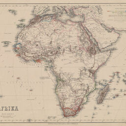
Afrika
Permalink
https://digital.library.illinois.edu/items/2ca77070-e946-0133-1d3d-0050569601ca-b
This item is in the public domain.
Descriptive Information
| Title | Afrika |
| Creator | Ravenstein, Ernst Georg, 1834-1913 |
| Date | 1863 |
| Dimensions | 30.9 x 38 cm |
| Place of Publication | Germany |
| Cartographic Scale | 1:30,000,000 |
| Coverage-Spatial | Africa |
| Genre | Maps |
| Color | Printed and hand colored |
| Technique | Lithography |
| Source | Meyer's Hand-Atlasder neuesten Erdbeschreibung in 100 Karten, plate 87. |
| Physical Location | stx |
| Map No. in Bassett and Scheven Bibliography | 240 |
| Call Number | F_912M575 |
| Map ID | afm0000240 |
| Rights | No Copyright - United States |
| Rights Description | This item is in the public domain. |
| Collection Title | Maps of Africa to 1900 |
| Repository | Rare Book & Manuscript Library |
| Type | Cartographic material |
| Collection | Maps of Africa to 1900 |
Download Options
Contact us
for questions and to provide feedback.