
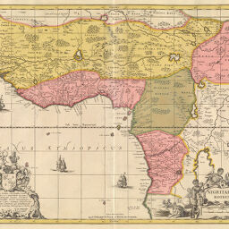
Nigritarum Regnum
Permalink
https://digital.library.illinois.edu/items/2cf85270-e946-0133-1d3d-0050569601ca-1
This item is in the public domain.
Descriptive Information
| Title | Nigritarum Regnum |
| Creator | Valck, G. (Gerard), 1651 or 1652-1726 |
| Date | 1712 |
| Dimensions | 43 x 56.8 cm |
| Place of Publication | Germany |
| Cartographic Scale | 1:11,950,000 |
| Coverage-Spatial | Africa, West |
| Genre | Maps |
| Language | Latin |
| Source | Allgemeiner Atlas, V. 4, plate 390. |
| Physical Location | rbx |
| Map No. in Bassett and Scheven Bibliography | 2143 |
| Call Number | XF_912H75A |
| Map ID | afm0002143 |
| Rights | No Copyright - United States |
| Rights Description | This item is in the public domain. |
| Collection Title | Maps of Africa to 1900 |
| Repository | Rare Book & Manuscript Library |
| Type | Cartographic material |
| Collection | Maps of Africa to 1900 |
Download Options
|
Nigritarum Regnum |
Contact us
for questions and to provide feedback.