
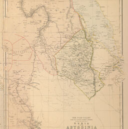
Nile-Valley from the Second Cataract Upwards...
Permalink
https://digital.library.illinois.edu/items/2d5a1880-e946-0133-1d3d-0050569601ca-b
This item is in the public domain.
Descriptive Information
| Title | Nile-Valley from the Second Cataract Upwards... |
| Creator | Blackie, W. G. (Walter Graham), 1816-1906 |
| Date | 1884 |
| Dimensions | 34.8 x 25.1 cm |
| Place of Publication | England |
| Cartographic Scale | 1:6,700,000 |
| Coverage-Spatial | Africa |
| Genre | Maps |
| Language | English |
| Color | Printed color |
| Technique | Lithography |
| Source | Comprehensive Atlas, plate 45. |
| Physical Location | mar |
| Map No. in Bassett and Scheven Bibliography | 329 |
| Call Number | Q_912B56C |
| Map ID | afm0000329 |
| Rights | No Copyright - United States |
| Rights Description | This item is in the public domain. |
| Collection Title | Maps of Africa to 1900 |
| Repository | Rare Book & Manuscript Library |
| Type | Cartographic material |
| Collection | Maps of Africa to 1900 |
Download Options
|
Nile-Valley from the Second Cataract Upwards... |
Contact us
for questions and to provide feedback.