
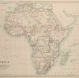
Africa
Permalink
https://digital.library.illinois.edu/items/2dc56660-e946-0133-1d3d-0050569601ca-1
This item is in the public domain.
Descriptive Information
| Title | Africa |
| Creator | Johnston, W. & A. K., Pub. |
| Date | 1889 |
| Dimensions | 32.2 x 42.5 cm |
| Place of Publication | England |
| Cartographic Scale | 1:26,500,000 |
| Notes | Whole signature separated from binding. |
| Coverage-Spatial | Africa |
| Genre | Maps |
| Color | Printed color |
| Technique | Lithography and aquatint |
| Source | Cosmographic Atlas, p. 30. |
| Physical Location | stx |
| Map No. in Bassett and Scheven Bibliography | 372 |
| Call Number | F_912J649C1889 |
| Map ID | afm0000372 |
| Rights | No Copyright - United States |
| Rights Description | This item is in the public domain. |
| Collection Title | Maps of Africa to 1900 |
| Repository | Rare Book & Manuscript Library |
| Type | Cartographic material |
| Collection | Maps of Africa to 1900 |
Download Options
Contact us
for questions and to provide feedback.