
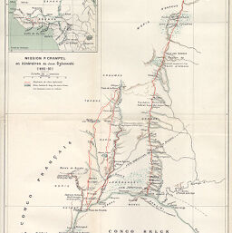
Mission P. Crampel et itinéraires de Jean Dybowski (1890-92)
Permalink
https://digital.library.illinois.edu/items/2dc9fa80-e946-0133-1d3d-0050569601ca-4
This item is in the public domain.
Descriptive Information
| Title | Mission P. Crampel et itinéraires de Jean Dybowski (1890-92) |
| Creator | Armand Colin (Firm) |
| Date | 1892 |
| Dimensions | 27.1 x 39.7 cm |
| Place of Publication | France |
| Cartographic Scale | 1:1,000,000 |
| Notes | Relief shown by hachures and spot heights. Includes 1 inset location map. |
| Coverage-Spatial | Central African Republic |
| Subject | |
| Genre | Maps |
| Language | French |
| Color | Printed color |
| Technique | Lithography |
| Source | Annales de géographie : bulletin de la Société de géographie, V. 2, between pp. 272-273. |
| Physical Location | stx |
| Map No. in Bassett and Scheven Bibliography | 2045 |
| Call Number | 910_5AN |
| Map ID | afm0002045 |
| Rights | No Copyright - United States |
| Rights Description | This item is in the public domain. |
| Collection Title | Maps of Africa to 1900 |
| Repository | Rare Book & Manuscript Library |
| Type | Cartographic material |
| Collection | Maps of Africa to 1900 |
Download Options
|
Mission P. Crampel et itinéraires de Jean Dybowski (1890-92) |
Contact us
for questions and to provide feedback.