
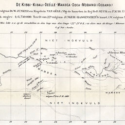
De Kibbi - Kibali - Oeélle - Makoea - Doea - Mobangi (Oebangi) volgens Dr. W. Junker en Kapitein Van Gèle
Permalink
https://digital.library.illinois.edu/items/2e385b30-e946-0133-1d3d-0050569601ca-a
This item is in the public domain.
Descriptive Information
| Title | De Kibbi - Kibali - Oeélle - Makoea - Doea - Mobangi (Oebangi) volgens Dr. W. Junker en Kapitein Van Gèle |
| Creator | Hassenstein, Bruno |
| Date | 1889 |
| Dimensions | 10.5 x 22.5 cm |
| Cartographic Scale | 1:6,750,000 |
| Coverage-Spatial | Uele River (Congo, Democratic Republic) |
| Subject | |
| Genre | Maps |
| Color | Bitonal |
| Technique | Lithography |
| Source | Tijdschrift, series 2, V. 6, section 2, between pp. 412-413. |
| Physical Location | stx |
| Map No. in Bassett and Scheven Bibliography | 2012 |
| Call Number | 910_6NESER_2 |
| Map ID | afm0002012 |
| Rights | No Copyright - United States |
| Rights Description | This item is in the public domain. |
| Collection Title | Maps of Africa to 1900 |
| Repository | Rare Book & Manuscript Library |
| Type | Cartographic material |
| Collection | Maps of Africa to 1900 |
Download Options
|
De Kibbi - Kibali - Oeélle - Makoea - Doea - Mobangi (Oebangi) volgens Dr. W. Junker en Kapitein Van Gèle |
Contact us
for questions and to provide feedback.