
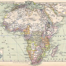
Africa (Politica)
Permalink
https://digital.library.illinois.edu/items/2e7203c0-e946-0133-1d3d-0050569601ca-0
This item is in the public domain.
Descriptive Information
| Title | Africa (Politica) |
| Creator | Roggero, Giuseppe |
| Date | 1897 |
| Dimensions | 19.5 x 26 cm |
| Place of Publication | Italy |
| Cartographic Scale | 1:40,000,000 |
| Notes | Relief shown by hachures. Inset of Italy for size comparison. |
| Coverage-Spatial | Africa |
| Subject | |
| Genre | Maps |
| Language | Italian |
| Color | Printed color |
| Technique | Lithography |
| Source | Testo-atlante scolastico di geografia moderna, V. 4, plate 34. |
| Physical Location | stx |
| Map No. in Bassett and Scheven Bibliography | 448 |
| Call Number | Q_910R633 (not Q_ 910 R633T?) |
| Map ID | afm0000448 |
| Rights | No Copyright - United States |
| Rights Description | This item is in the public domain. |
| Collection Title | Maps of Africa to 1900 |
| Repository | Rare Book & Manuscript Library |
| Type | Cartographic material |
| Collection | Maps of Africa to 1900 |
Download Options
|
Africa (Politica) |
Contact us
for questions and to provide feedback.