
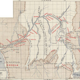
Exploraciones de Stanley 1876 y 1877
Permalink
https://digital.library.illinois.edu/items/2f79bd80-e946-0133-1d3d-0050569601ca-3
This item is in the public domain.
Descriptive Information
| Title | Exploraciones de Stanley 1876 y 1877 |
| Creator | Coello, Francisco, 1822-1898 |
| Date | 1877 |
| Dimensions | 19.8 x 25.9 cm |
| Cartographic Scale | 1:10,000,000 |
| Notes | Part of a larger plate with ID Nos. 1183, 1184, 1185, 1677, 1885, and one non-Africa map. |
| Coverage-Spatial | Africa, Central |
| Genre | Maps |
| Language | Spanish |
| Color | Printed color |
| Technique | Lithography and aquatint |
| Source | Boletín de la Real Sociedad Geográfica, V. 3, No. 2, after p. 576. |
| Physical Location | stx |
| Map No. in Bassett and Scheven Bibliography | 1886 |
| Call Number | 910_6SOM |
| Map ID | afm0001886 |
| Rights | No Copyright - United States |
| Rights Description | This item is in the public domain. |
| Collection Title | Maps of Africa to 1900 |
| Repository | Rare Book & Manuscript Library |
| Type | Cartographic material |
| Collection | Maps of Africa to 1900 |
Download Options
|
Exploraciones de Stanley 1876 y 1877 |
Contact us
for questions and to provide feedback.