
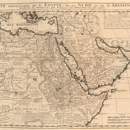
Carte Particuliere de Egypte, de la Nubie et de Abyssinie
Permalink
https://digital.library.illinois.edu/items/2fb0b840-e946-0133-1d3d-0050569601ca-0
This item is in the public domain.
Descriptive Information
| Title | Carte Particuliere de Egypte, de la Nubie et de Abyssinie |
| Creator | Chatelain, Henri Abraham |
| Date | 1719 |
| Dimensions | 39.7 x 51.2 cm |
| Place of Publication | Netherlands |
| Cartographic Scale | 1:11,475,000 |
| Coverage-Spatial | Africa, North |
| Genre | Maps |
| Language | Latin |
| Source | Atlas historique, V. 6, p. 7. |
| Physical Location | rbx |
| Map No. in Bassett and Scheven Bibliography | 586 |
| Call Number | XF_912C39A |
| Map ID | afm0000586 |
| Rights | No Copyright - United States |
| Rights Description | This item is in the public domain. |
| Collection Title | Maps of Africa to 1900 |
| Repository | Rare Book & Manuscript Library |
| Type | Cartographic material |
| Collection | Maps of Africa to 1900 |
Download Options
|
Carte Particuliere de Egypte, de la Nubie et de Abyssinie |
Contact us
for questions and to provide feedback.