
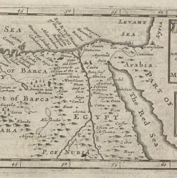
Egypt and Barca etc.
Permalink
https://digital.library.illinois.edu/items/2fb5cca0-e946-0133-1d3d-0050569601ca-7
This item is in the public domain.
Descriptive Information
| Title | Egypt and Barca etc. |
| Creator | Moll, Herman, -1732 |
| Date | 1722 |
| Dimensions | 8.5 x 19 cm |
| Place of Publication | England |
| Cartographic Scale | 1:19,500,000 |
| Coverage-Spatial | Africa, North |
| Genre | Maps |
| Language | English |
| Source | Compleat Geographer, part 2, p. 135. |
| Physical Location | rbx and loose sheet: G8580127-?M6/max |
| Map No. in Bassett and Scheven Bibliography | 588 |
| Call Number | XQ_910C7371722 |
| Map ID | afm0000588 |
| Rights | No Copyright - United States |
| Rights Description | This item is in the public domain. |
| Collection Title | Maps of Africa to 1900 |
| Repository | Rare Book & Manuscript Library |
| Type | Cartographic material |
| Collection | Maps of Africa to 1900 |
Download Options
|
Egypt and Barca etc. |
Contact us
for questions and to provide feedback.