
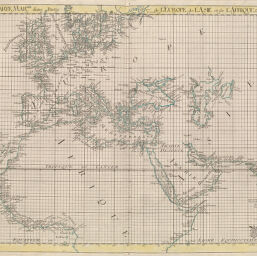
Carte marine de Europe, de Asie et de Afrique
Permalink
https://digital.library.illinois.edu/items/2fda18c0-e946-0133-1d3d-0050569601ca-b
This item is in the public domain.
Descriptive Information
| Title | Carte marine de Europe, de Asie et de Afrique |
| Creator | Brückner, Isaak, 1686-1762 |
| Date | 1749 |
| Dimensions | 43.6 x 50.6 cm |
| Place of Publication | England |
| Cartographic Scale | 1:19,820,000 |
| Coverage-Spatial | Africa, North |
| Genre | Maps |
| Source | Nouvel atlas, plate 5. |
| Physical Location | rbx |
| Map No. in Bassett and Scheven Bibliography | 604 |
| Call Number | XF_912B83N |
| Map ID | afm0000604 |
| Rights | No Copyright - United States |
| Rights Description | This item is in the public domain. |
| Collection Title | Maps of Africa to 1900 |
| Repository | Rare Book & Manuscript Library |
| Type | Cartographic material |
| Collection | Maps of Africa to 1900 |
Download Options
|
Carte marine de Europe, de Asie et de Afrique |
Contact us
for questions and to provide feedback.