
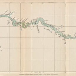
Chart of the Quanza River from the Bar to the Livingstone Falls. Surveyed and drawn by Carl Alexanderson 1873-1874
Permalink
https://digital.library.illinois.edu/items/2fff54c0-e946-0133-1d3d-0050569601ca-4
This item is in the public domain.
Descriptive Information
| Title | Chart of the Quanza River from the Bar to the Livingstone Falls. Surveyed and drawn by Carl Alexanderson 1873-1874 |
| Creator | Alexanderson, Carl |
| Date | 1874 |
| Dimensions | 18.8 x 65.1 cm |
| Cartographic Scale | 1:310,000 |
| Coverage-Spatial | Africa, Central |
| Genre | Maps |
| Language | English |
| Source | Journal of the Royal Geographic Society, V. 46, between pp. 428-429. |
| Physical Location | rbx |
| Map No. in Bassett and Scheven Bibliography | 1865 |
| Call Number | 910_6ROJ (Online resource, http://www_library_uiuc_edu/orr/results_php?resid=35994) |
| Map ID | afm0001865 |
| Rights | No Copyright - United States |
| Rights Description | This item is in the public domain. |
| Collection Title | Maps of Africa to 1900 |
| Repository | Rare Book & Manuscript Library |
| Type | Cartographic material |
| Collection | Maps of Africa to 1900 |
Download Options
|
Chart of the Quanza River from the Bar to the Livingstone Falls. Surveyed and drawn by Carl Alexanderson 1873-1874 |
Contact us
for questions and to provide feedback.