
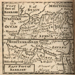
West and East Parts of Barbary
Permalink
https://digital.library.illinois.edu/items/301fb2a0-e946-0133-1d3d-0050569601ca-0
This item is in the public domain.
Descriptive Information
| Title | West and East Parts of Barbary |
| Creator | Hübner, Johann |
| Date | 1767 |
| Dimensions | 6.8 x 7.2 cm |
| Place of Publication | England |
| Cartographic Scale | 1:40,000,000 |
| Coverage-Spatial | Africa, North |
| Genre | Maps |
| Language | English |
| Source | New and Easy Introduction, p. 213. |
| Physical Location | rbx |
| Map No. in Bassett and Scheven Bibliography | 630 |
| Call Number | X910H864KE1767 |
| Map ID | afm0000630 |
| Rights | No Copyright - United States |
| Rights Description | This item is in the public domain. |
| Collection Title | Maps of Africa to 1900 |
| Repository | Rare Book & Manuscript Library |
| Type | Cartographic material |
| Collection | Maps of Africa to 1900 |
Download Options
|
West and East Parts of Barbary |
Contact us
for questions and to provide feedback.