
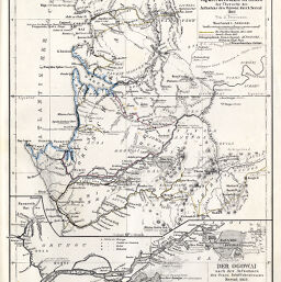
Karte der Gabun-Länder im Äquatorialen Afrika Zur Übersicht der Aufnahme des Ogowai durch Serval, 1862
Permalink
https://digital.library.illinois.edu/items/3025a040-e946-0133-1d3d-0050569601ca-f
This item is in the public domain.
Descriptive Information
| Title | Karte der Gabun-Länder im Äquatorialen Afrika Zur Übersicht der Aufnahme des Ogowai durch Serval, 1862 |
| Creator | Debes, E. (Ernst), 1840-1923 |
| Date | 1863 |
| Dimensions | 24 x 19 cm |
| Place of Publication | Germany |
| Cartographic Scale | 1:2,000,000 |
| Notes | Includes 1 inset map (scale 1:1,000,000): Der Ogowai. Explorer's routes indicated by colored lines. |
| Coverage-Spatial | Ogooué River (Gabon) |
| Subject | |
| Genre | Maps |
| Language | German |
| Color | Hand colored |
| Technique | Lithography |
| Source | Petermanns geographische Mitteilungen, V. 9, plate 15. |
| Physical Location | stx |
| Map No. in Bassett and Scheven Bibliography | 1855 |
| Call Number | Q_910_5PE |
| Map ID | afm0001855 |
| Rights | No Copyright - United States |
| Rights Description | This item is in the public domain. |
| Collection Title | Maps of Africa to 1900 |
| Repository | Rare Book & Manuscript Library |
| Type | Cartographic material |
| Collection | Maps of Africa to 1900 |
Download Options
|
Karte der Gabun-Länder im Äquatorialen Afrika Zur Übersicht der Aufnahme des Ogowai durch Serval, 1862 |
Contact us
for questions and to provide feedback.