
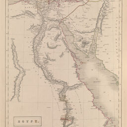
Egypt
Permalink
https://digital.library.illinois.edu/items/31095b10-e946-0133-1d3d-0050569601ca-7
This item is in the public domain.
Descriptive Information
| Title | Egypt |
| Creator | Hall, Sidney |
| Date | 1861 |
| Dimensions | 37 x 26 cm |
| Place of Publication | England |
| Cartographic Scale | 1:300,000 |
| Notes | Incorrect call No. given, correct call No. is F.912H147b. |
| Coverage-Spatial | Africa, North |
| Genre | Maps |
| Color | Hand colored |
| Technique | Etched or engraved |
| Source | Black's General Atlas, plate 43. |
| Physical Location | ihq (maos)?? |
| Map No. in Bassett and Scheven Bibliography | 725 |
| Call Number | F_912H147b |
| Map ID | afm0000725 |
| Rights | No Copyright - United States |
| Rights Description | This item is in the public domain. |
| Collection Title | Maps of Africa to 1900 |
| Repository | Rare Book & Manuscript Library |
| Type | Cartographic material |
| Collection | Maps of Africa to 1900 |
Download Options
Contact us
for questions and to provide feedback.