


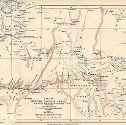
Part of British Central Africa...
Permalink
https://digital.library.illinois.edu/items/3130fd90-e946-0133-1d3d-0050569601ca-1
This item is in the public domain.
Descriptive Information
| Title | Part of British Central Africa... |
| Creator | Thomson, Joseph, 1858-1895 |
| Date | 1891 |
| Dimensions | 21.6 x 42.6 cm |
| Place of Publication | England |
| Cartographic Scale | 1:2,000,000 |
| Notes | Includes inset continuation. |
| Coverage-Spatial | Malawi |
| Subject | |
| Genre | Maps |
| Language | English |
| Color | Printed color |
| Technique | Lithography |
| Source | The Geographical Journal, V. 1, between pp. 192-193. |
| Physical Location | stx |
| Map No. in Bassett and Scheven Bibliography | 1758 |
| Call Number | 910_5GJ |
| Map ID | afm0001758 |
| Rights | No Copyright - United States |
| Rights Description | This item is in the public domain. |
| Collection Title | Maps of Africa to 1900 |
| Repository | Rare Book & Manuscript Library |
| Type | Cartographic material |
| Collection | Maps of Africa to 1900 |
Download Options
|
Part of British Central Africa... |
Contact us
for questions and to provide feedback.