
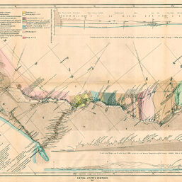
Originalkarte des Unteren !Khuiseb Thales von F.M. Staapff…
Permalink
https://digital.library.illinois.edu/items/316649b0-e946-0133-1d3d-0050569601ca-3
This item is in the public domain.
Descriptive Information
| Title | Originalkarte des Unteren !Khuiseb Thales von F.M. Staapff… |
| Creator | Stapff, F.M. |
| Date | 1887 |
| Dimensions | 42.6 x 69.5 cm |
| Place of Publication | Germany |
| Cartographic Scale | 1:225,000 |
| Notes | Relief shown by shading and spot heights. Includes 2 inset elevation profiles. Oriented with north to the upper left. |
| Coverage-Spatial | Namibia |
| Subject | |
| Genre | Maps |
| Language | German |
| Color | Printed color |
| Technique | Lithography |
| Source | Petermanns geographische Mitteilungen, V. 33, plate 11. |
| Physical Location | stx |
| Map No. in Bassett and Scheven Bibliography | 1732 |
| Call Number | Q_910_5PE |
| Map ID | afm0001732 |
| Rights | No Copyright - United States |
| Rights Description | This item is in the public domain. |
| Collection Title | Maps of Africa to 1900 |
| Repository | Rare Book & Manuscript Library |
| Type | Cartographic material |
| Collection | Maps of Africa to 1900 |
Download Options
|
Originalkarte des Unteren !Khuiseb Thales von F.M. Staapff… |
Contact us
for questions and to provide feedback.