
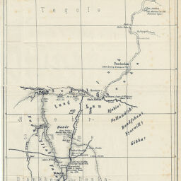
Karte des Bachr el Abiad & Bachr el Gebel V. Chartum bis Regaf
Permalink
https://digital.library.illinois.edu/items/31a1f670-e946-0133-1d3d-0050569601ca-9
This item is in the public domain.
Descriptive Information
| Title | Karte des Bachr el Abiad & Bachr el Gebel V. Chartum bis Regaf |
| Creator | Österreichische Geographische Gesellschaft |
| Date | 1875 |
| Dimensions | 67.3 x 22 cm |
| Place of Publication | Austria |
| Cartographic Scale | 1:2,000,000 |
| Coverage-Spatial | Africa, North |
| Genre | Maps |
| Language | German |
| Color | Bitonal |
| Technique | Lithography |
| Source | Mitteilungen der Österreichischen Geographischen Gesellschaft, V. 18, after p. 592. |
| Physical Location | stx |
| Map No. in Bassett and Scheven Bibliography | 794 |
| Call Number | 910_5GEOW |
| Map ID | afm0000794 |
| Rights | No Copyright - United States |
| Rights Description | This item is in the public domain. |
| Collection Title | Maps of Africa to 1900 |
| Repository | Rare Book & Manuscript Library |
| Type | Cartographic material |
| Collection | Maps of Africa to 1900 |
Download Options
|
Karte des Bachr el Abiad & Bachr el Gebel V. Chartum bis Regaf |
Contact us
for questions and to provide feedback.