
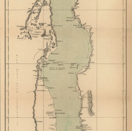
Africa: Lake Nyassa surveyed by Mr. Jas. Stewart, C.E.
Permalink
https://digital.library.illinois.edu/items/31c6dc70-e946-0133-1d3d-0050569601ca-2
This item is in the public domain.
Descriptive Information
| Title | Africa: Lake Nyassa surveyed by Mr. Jas. Stewart, C.E. |
| Creator | Sharbau, H. (Henry) |
| Date | 1883 |
| Dimensions | 49.3 x 20.5 cm |
| Cartographic Scale | 1:1,215,000 |
| Coverage-Spatial | Africa, Southern |
| Genre | Maps |
| Language | English |
| Source | Proceedings of the Royal Geographical Society, V. 5, No. 12, after p. 752. |
| Physical Location | rbx |
| Map No. in Bassett and Scheven Bibliography | 1704 |
| Call Number | 910_6RLn_s_ |
| Map ID | afm0001704 |
| Rights | No Copyright - United States |
| Rights Description | This item is in the public domain. |
| Collection Title | Maps of Africa to 1900 |
| Repository | Rare Book & Manuscript Library |
| Type | Cartographic material |
| Collection | Maps of Africa to 1900 |
Download Options
|
Africa: Lake Nyassa surveyed by Mr. Jas. Stewart, C.E. |
Contact us
for questions and to provide feedback.