
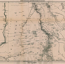
Zoeppritz, Speciakarte vom Mittleren Ost-Sudan (Südliches Blatt)
Permalink
https://digital.library.illinois.edu/items/31d84fd0-e946-0133-1d3d-0050569601ca-9
This item is in the public domain.
Descriptive Information
| Title | Zoeppritz, Speciakarte vom Mittleren Ost-Sudan (Südliches Blatt) |
| Creator | Zoeppritz, K. |
| Date | 1877 |
| Dimensions | 33.5 x 48.5 cm |
| Place of Publication | Germany |
| Cartographic Scale | 1:1,000,000 |
| Notes | Relief shown by hachures. Southern sheet of Speciakarte vom Mittleren Ost-Sudan (map No. 813 in Basset). |
| Coverage-Spatial | Nile River Watershed |
| Subject | |
| Genre | Maps |
| Language | German |
| Color | Hand colored |
| Technique | Lithography |
| Source | Petermanns geographische Mitteilungen, V. 11, No. 51, between pp. 48-49. |
| Physical Location | stx |
| Map No. in Bassett and Scheven Bibliography | 814 |
| Call Number | Q_910_5PE |
| Map ID | afm0000814 |
| Rights | No Copyright - United States |
| Rights Description | This item is in the public domain. |
| Collection Title | Maps of Africa to 1900 |
| Repository | Rare Book & Manuscript Library |
| Type | Cartographic material |
| Collection | Maps of Africa to 1900 |
Download Options
|
Zoeppritz, Speciakarte vom Mittleren Ost-Sudan (Südliches Blatt) |
Contact us
for questions and to provide feedback.