


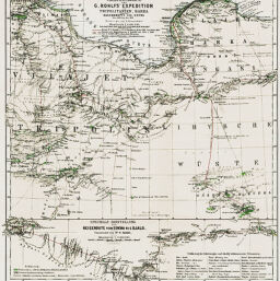
Übersichtskarte von G. Rohlfs' Expedition in Tripolitanien, Barka und der Oasengruppe von Kufra Dec. 1878 bis Oct. 1879
Permalink
https://digital.library.illinois.edu/items/32051d60-e946-0133-1d3d-0050569601ca-9
This item is in the public domain.
Descriptive Information
| Title | Übersichtskarte von G. Rohlfs' Expedition in Tripolitanien, Barka und der Oasengruppe von Kufra Dec. 1878 bis Oct. 1879 |
| Creator | Schmidt, C. |
| Date | 1880 |
| Dimensions | 31.7 x 29. 4 cm |
| Place of Publication | Germany |
| Cartographic Scale | 1:4,000,000 |
| Notes | Includes 1 inset map (scale 1:2,000,000): Specielle darstellung der Reiseroute von Sokna bis Djalo. |
| Coverage-Spatial | Tripolitania |
| Subject | |
| Genre | Maps |
| Language | German |
| Color | Hand colored |
| Technique | Lithography |
| Source | Petermanns geographische Mitteilungen, V. 26, plate 21. |
| Physical Location | stx |
| Map No. in Bassett and Scheven Bibliography | 828 |
| Call Number | Q_910_5PE |
| Map ID | afm0000828 |
| Rights | No Copyright - United States |
| Rights Description | This item is in the public domain. |
| Collection Title | Maps of Africa to 1900 |
| Repository | Rare Book & Manuscript Library |
| Type | Cartographic material |
| Collection | Maps of Africa to 1900 |
Download Options
|
Übersichtskarte von G. Rohlfs' Expedition in Tripolitanien, Barka und der Oasengruppe von Kufra Dec. 1878 bis Oct. 1879 |
Contact us
for questions and to provide feedback.