
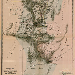
Originalkarte der Quellgebiete der flüsse Tumat, Jabus u. Jal
Permalink
https://digital.library.illinois.edu/items/32549dc0-e946-0133-1d3d-0050569601ca-8
This item is in the public domain.
Descriptive Information
| Title | Originalkarte der Quellgebiete der flüsse Tumat, Jabus u. Jal |
| Creator | Schuver, Juan Maria, 1852-1883 |
| Date | 1883 |
| Dimensions | 47.1 x 35 cm |
| Place of Publication | Germany |
| Cartographic Scale | 1:500,000 |
| Notes | Relief shown by landform drawings. |
| Coverage-Spatial | Tumat River (Sudan) |
| Subject | |
| Genre | Maps |
| Language | German |
| Color | Hand colored |
| Technique | Lithography |
| Source | Petermanns geographische Mitteilungen, V. 29, plate 4. |
| Physical Location | stx |
| Map No. in Bassett and Scheven Bibliography | 862 |
| Call Number | Q_910_5PE |
| Map ID | afm0000862 |
| Rights | No Copyright - United States |
| Rights Description | This item is in the public domain. |
| Collection Title | Maps of Africa to 1900 |
| Repository | Rare Book & Manuscript Library |
| Type | Cartographic material |
| Collection | Maps of Africa to 1900 |
Download Options
|
Originalkarte der Quellgebiete der flüsse Tumat, Jabus u. Jal |
Contact us
for questions and to provide feedback.