
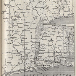
[Carte du Pays des Éoués (Dahomey Occidental)]
Permalink
https://digital.library.illinois.edu/items/33328e10-e946-0133-1d3d-0050569601ca-6
This item is in the public domain.
Descriptive Information
| Title | [Carte du Pays des Éoués (Dahomey Occidental)] |
| Creator | Chesneau, Marius |
| Date | 1895 |
| Dimensions | 13.4 x 11.6 cm |
| Place of Publication | France |
| Cartographic Scale | 1:3,550,000 |
| Notes | Includes 1 inset map: Habitat des Éoués. |
| Coverage-Spatial | Dahomey |
| Subject | |
| Genre | Maps |
| Language | French |
| Color | Bitonal |
| Technique | Non-wood Relief |
| Source | Revue de geographie, V. 37, p. 305. |
| Physical Location | stx |
| Map No. in Bassett and Scheven Bibliography | 2341 |
| Call Number | 910_5RE |
| Map ID | afm0002341 |
| Rights | No Copyright - United States |
| Rights Description | This item is in the public domain. |
| Collection Title | Maps of Africa to 1900 |
| Repository | Rare Book & Manuscript Library |
| Type | Cartographic material |
| Collection | Maps of Africa to 1900 |
Download Options
|
[Carte du Pays des Éoués (Dahomey Occidental)] |
Contact us
for questions and to provide feedback.