
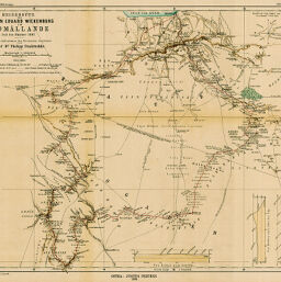
Reiseroute des Grafen Eduard Wickenburg im Somâllande Juli bis Oktober 1897...
Permalink
https://digital.library.illinois.edu/items/33692340-e946-0133-1d3d-0050569601ca-e
This item is in the public domain.
Descriptive Information
| Title | Reiseroute des Grafen Eduard Wickenburg im Somâllande Juli bis Oktober 1897... |
| Creator | Paulitschke, Philipp, 1854-1899 |
| Date | 1898 |
| Dimensions | 40.7 x 50 cm |
| Place of Publication | Germany |
| Cartographic Scale | 1:1,000,000 |
| Notes | Relief shown by hachures and spot heights. Includes 5 inset elevation profiles. |
| Coverage-Spatial | Ethiopia |
| Subject | |
| Genre | Maps |
| Language | German |
| Color | Printed color |
| Technique | Lithography |
| Source | Petermanns geographische Mitteilungen, V. 44, plate 5. |
| Physical Location | stx |
| Map No. in Bassett and Scheven Bibliography | 1549 |
| Call Number | Q_910_5PE |
| Map ID | afm0001549 |
| Rights | No Copyright - United States |
| Rights Description | This item is in the public domain. |
| Collection Title | Maps of Africa to 1900 |
| Repository | Rare Book & Manuscript Library |
| Type | Cartographic material |
| Collection | Maps of Africa to 1900 |
Download Options
|
Reiseroute des Grafen Eduard Wickenburg im Somâllande Juli bis Oktober 1897... |
Contact us
for questions and to provide feedback.