
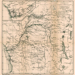
Schetskaart van den Congo - Vrijstaat volgens de kaarten van J. du Fief, A. Chapaux en J. Lebègue, en de aanteekeningen van A. Greshoff.
Permalink
https://digital.library.illinois.edu/items/338031a0-e946-0133-1d3d-0050569601ca-c
This item is in the public domain.
Descriptive Information
| Title | Schetskaart van den Congo - Vrijstaat volgens de kaarten van J. du Fief, A. Chapaux en J. Lebègue, en de aanteekeningen van A. Greshoff. |
| Creator | Lebègue, J. |
| Date | 1895 |
| Dimensions | 31.4 x 30.3 cm |
| Cartographic Scale | 1:8,000,000 |
| Notes | Includes 1 inset map: De Beneden-Congo. |
| Coverage-Spatial | Angola |
| Subject | |
| Genre | Maps |
| Language | German |
| Color | Bitonal |
| Source | Tijdschrift, series 2, V. 12, after p. 846. |
| Physical Location | stx |
| Map No. in Bassett and Scheven Bibliography | 2080 |
| Call Number | 910_6NESER_2 |
| Map ID | afm0002080 |
| Rights | No Copyright - United States |
| Rights Description | This item is in the public domain. |
| Collection Title | Maps of Africa to 1900 |
| Repository | Rare Book & Manuscript Library |
| Type | Cartographic material |
| Collection | Maps of Africa to 1900 |
Download Options
|
Schetskaart van den Congo - Vrijstaat volgens de kaarten van J. du Fief, A. Chapaux en J. Lebègue, en de aanteekeningen van A. Greshoff. |
Contact us
for questions and to provide feedback.