
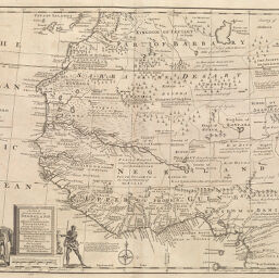
New & Accurate Map of Negroland
Permalink
https://digital.library.illinois.edu/items/338af630-e946-0133-1d3d-0050569601ca-8
This item is in the public domain.
Descriptive Information
| Title | New & Accurate Map of Negroland |
| Creator | Bowen, Emanuel, 1693 or 1694-1767 |
| Date | 1747 |
| Dimensions | 34.5 x 42.6 cm |
| Place of Publication | England |
| Cartographic Scale | 1:9,750,000 |
| Coverage-Spatial | Africa, West |
| Genre | Maps |
| Language | English |
| Color | Printed color |
| Technique | Etched or engraved |
| Source | A complete system of geography, V. 2, between pp. 458 [sic] and 449. |
| Physical Location | ihlc |
| Map No. in Bassett and Scheven Bibliography | 2152 |
| Call Number | F_910B67C |
| Map ID | afm0002152 |
| Rights | No Copyright - United States |
| Rights Description | This item is in the public domain. |
| Collection Title | Maps of Africa to 1900 |
| Repository | Rare Book & Manuscript Library |
| Type | Cartographic material |
| Collection | Maps of Africa to 1900 |
Download Options
|
New & Accurate Map of Negroland |
Contact us
for questions and to provide feedback.