
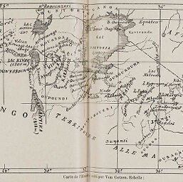
Carte de l'itinéraire suivi par Von Gotzen
Permalink
https://digital.library.illinois.edu/items/34260760-e946-0133-1d3d-0050569601ca-f
This item is in the public domain.
Descriptive Information
| Title | Carte de l'itinéraire suivi par Von Gotzen |
| Creator | Götzen, Gustav Adolf von, Graf, 1866-1910 |
| Date | 1895 |
| Dimensions | 12.6 x 25.4 cm |
| Place of Publication | France |
| Cartographic Scale | 1:7,200,000 |
| Coverage-Spatial | Africa, Eastern |
| Subject | |
| Genre | Maps |
| Language | French |
| Color | Bitonal |
| Technique | Lithography |
| Source | Revue géographique internationale, V. 20, pp. 68-69. |
| Physical Location | stos |
| Map No. in Bassett and Scheven Bibliography | 1485 |
| Call Number | 910_5REGI |
| Map ID | afm0001485 |
| Rights | No Copyright - United States |
| Rights Description | This item is in the public domain. |
| Collection Title | Maps of Africa to 1900 |
| Repository | Rare Book & Manuscript Library |
| Type | Cartographic material |
| Collection | Maps of Africa to 1900 |
Download Options
|
Carte de l'itinéraire suivi par Von Gotzen |
Contact us
for questions and to provide feedback.