
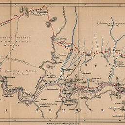
Ong'ulahi River and Adjacent Country on the West Coast of Madagascar...
Permalink
https://digital.library.illinois.edu/items/342fefc0-e946-0133-1d3d-0050569601ca-7
This item is in the public domain.
Descriptive Information
| Title | Ong'ulahi River and Adjacent Country on the West Coast of Madagascar... |
| Creator | Last, J. T. (Joseph Thomas) |
| Date | 1895 |
| Dimensions | 19.9 x 48.9 cm |
| Place of Publication | England |
| Cartographic Scale | 1:291,450 |
| Notes | Relief shown by hachures. Last's routes indicated in red. |
| Coverage-Spatial | Madagascar |
| Subject | |
| Genre | Maps |
| Language | English |
| Color | Printed color |
| Technique | Lithography |
| Source | The Geographical Journal, V. 6, between pp. 300-301. |
| Physical Location | stx |
| Map No. in Bassett and Scheven Bibliography | 1489 |
| Call Number | 910_5GJ |
| Map ID | afm0001489 |
| Rights | No Copyright - United States |
| Rights Description | This item is in the public domain. |
| Collection Title | Maps of Africa to 1900 |
| Repository | Rare Book & Manuscript Library |
| Type | Cartographic material |
| Collection | Maps of Africa to 1900 |
Download Options
|
Ong'ulahi River and Adjacent Country on the West Coast of Madagascar... |
Contact us
for questions and to provide feedback.