
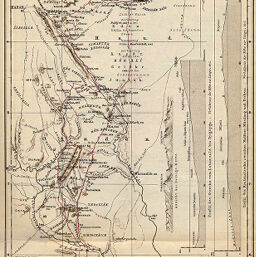
Reiseroute der Fürsten Demeter Ghika Comanesti im Somal-Lande, 1895 und 1896
Permalink
https://digital.library.illinois.edu/items/345048a0-e946-0133-1d3d-0050569601ca-d
This item is in the public domain.
Descriptive Information
| Title | Reiseroute der Fürsten Demeter Ghika Comanesti im Somal-Lande, 1895 und 1896 |
| Creator | Paulitschke, Philipp, 1854-1899 |
| Date | 1896 |
| Dimensions | 30.5 x 19.1 cm |
| Place of Publication | Germany |
| Cartographic Scale | 1:2,000,000 |
| Notes | Relief shown by hachures and spot heights. Includes 3 inset elevation profiles. |
| Coverage-Spatial | Italian Somaliland |
| Subject | |
| Genre | Maps |
| Language | German |
| Color | Printed color |
| Technique | Lithography |
| Source | Petermanns geographische Mitteilungen, V. 42, plate 18. |
| Physical Location | stx |
| Map No. in Bassett and Scheven Bibliography | 1517 |
| Call Number | Q_910_5PE |
| Map ID | afm0001517 |
| Rights | No Copyright - United States |
| Rights Description | This item is in the public domain. |
| Collection Title | Maps of Africa to 1900 |
| Repository | Rare Book & Manuscript Library |
| Type | Cartographic material |
| Collection | Maps of Africa to 1900 |
Download Options
|
Reiseroute der Fürsten Demeter Ghika Comanesti im Somal-Lande, 1895 und 1896 |
Contact us
for questions and to provide feedback.