


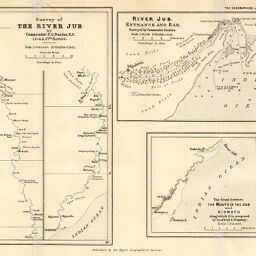
Survey of the River Jub
Permalink
https://digital.library.illinois.edu/items/350097b0-e946-0133-1d3d-0050569601ca-d
This item is in the public domain.
Descriptive Information
| Title | Survey of the River Jub |
| Creator | Dundas, F.G. |
| Date | 1893 |
| Dimensions | 19.8 x 27 cm |
| Place of Publication | England |
| Cartographic Scale | 1:1,000,000 |
| Notes | Relief shown by soundings. Includes 2 ancillary maps: River Jub, Entrance and Bar -- The Coast between the mouth of the Jub and Kismayu. |
| Coverage-Spatial | Juba River (Ethiopia and Somalia) |
| Subject | |
| Genre | Maps |
| Language | English |
| Color | Printed color |
| Technique | Lithography |
| Source | The Geographical Journal, V. 1, between pp. 288-289. |
| Physical Location | stx |
| Map No. in Bassett and Scheven Bibliography | 1429 |
| Call Number | 910_5GJ |
| Map ID | afm0001429 |
| Rights | No Copyright - United States |
| Rights Description | This item is in the public domain. |
| Collection Title | Maps of Africa to 1900 |
| Repository | Rare Book & Manuscript Library |
| Type | Cartographic material |
| Collection | Maps of Africa to 1900 |
Download Options
|
Survey of the River Jub |
Contact us
for questions and to provide feedback.