


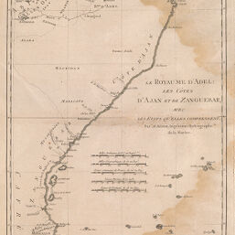
Le Royaume d'Adel: Les Côtes d'Ajan et de Zanguebar, avec les Etats qu'elles comprennent
Permalink
https://digital.library.illinois.edu/items/353c0090-e946-0133-1d3d-0050569601ca-a
This item is in the public domain.
Descriptive Information
| Title | Le Royaume d'Adel: Les Côtes d'Ajan et de Zanguebar, avec les Etats qu'elles comprennent |
| Creator | Bonne, Rigobert |
| Date | 1788 |
| Dimensions | 34.6 x 23.3 cm |
| Place of Publication | France |
| Cartographic Scale | 1:9,500,000 |
| Coverage-Spatial | Africa, Eastern |
| Genre | Maps |
| Language | French |
| Source | Atlas encyclopédique, V. 2, plate 97. |
| Physical Location | rbx |
| Map No. in Bassett and Scheven Bibliography | 1079 |
| Call Number | XQ_912AT65 |
| Map ID | afm0001079 |
| Rights | No Copyright - United States |
| Rights Description | This item is in the public domain. |
| Collection Title | Maps of Africa to 1900 |
| Repository | Rare Book & Manuscript Library |
| Type | Cartographic material |
| Collection | Maps of Africa to 1900 |
Download Options
|
Le Royaume d'Adel: Les Côtes d'Ajan et de Zanguebar, avec les Etats qu'elles comprennent |
Contact us
for questions and to provide feedback.