


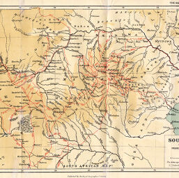
Part of South Africa showing the routes of Frederick Courtney Selous 1872-92
Permalink
https://digital.library.illinois.edu/items/357def50-e946-0133-1d3d-0050569601ca-b
This item is in the public domain.
Descriptive Information
| Title | Part of South Africa showing the routes of Frederick Courtney Selous 1872-92 |
| Creator | Ravenstein, Ernst Georg, 1834-1913 |
| Date | 1892 |
| Dimensions | 20.5 x 31.7 cm |
| Place of Publication | England |
| Cartographic Scale | 1:5,000,000 |
| Notes | Relief shown by tinting. |
| Coverage-Spatial | Zambezi River Valley |
| Subject | |
| Genre | Maps |
| Language | English |
| Color | Printed color |
| Technique | Lithography |
| Source | The Geographical Journal, V. 1, between pp. 384-385. |
| Physical Location | stx |
| Map No. in Bassett and Scheven Bibliography | 1406 |
| Call Number | 910_5GJ |
| Map ID | afm0001406 |
| Rights | No Copyright - United States |
| Rights Description | This item is in the public domain. |
| Collection Title | Maps of Africa to 1900 |
| Repository | Rare Book & Manuscript Library |
| Type | Cartographic material |
| Collection | Maps of Africa to 1900 |
Download Options
|
Part of South Africa showing the routes of Frederick Courtney Selous 1872-92 |
Contact us
for questions and to provide feedback.