
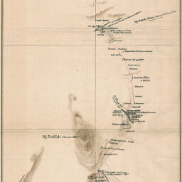
Esquisse topographique de l'Itinéraire suivi en 1884 par M.Mrs. H.L.M. et A.M. entre Ouezzann et Meknès
Permalink
https://digital.library.illinois.edu/items/358ffc20-e946-0133-1d3d-0050569601ca-e
This item is in the public domain.
Descriptive Information
| Title | Esquisse topographique de l'Itinéraire suivi en 1884 par M.Mrs. H.L.M. et A.M. entre Ouezzann et Meknès |
| Creator | Martinière, H. de la |
| Date | 1884 |
| Dimensions | 49.7 x 20.2 cm |
| Place of Publication | France |
| Cartographic Scale | 1:200,000 |
| Notes | Relief shown by hachures and spot heights. |
| Coverage-Spatial | Africa, North |
| Subject | |
| Genre | Maps |
| Language | French |
| Color | Printed color |
| Technique | Lithography |
| Source | Revue de geographie, V. 18, between pp. 160-161. |
| Physical Location | stx |
| Map No. in Bassett and Scheven Bibliography | 866 |
| Call Number | 910_5RE |
| Map ID | afm0000866 |
| Rights | No Copyright - United States |
| Rights Description | This item is in the public domain. |
| Collection Title | Maps of Africa to 1900 |
| Repository | Rare Book & Manuscript Library |
| Type | Cartographic material |
| Collection | Maps of Africa to 1900 |
Download Options
|
Esquisse topographique de l'Itinéraire suivi en 1884 par M.Mrs. H.L.M. et A.M. entre Ouezzann et Meknès |
Contact us
for questions and to provide feedback.