


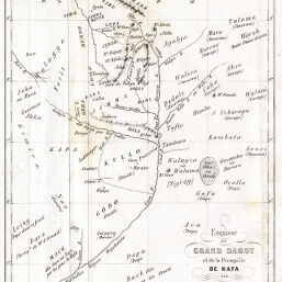
Esquisse du Grand Damot et de la Presqu'lle de Kafa
Permalink
https://digital.library.illinois.edu/items/364a53f0-e946-0133-1d3d-0050569601ca-a
This item is in the public domain.
Descriptive Information
| Title | Esquisse du Grand Damot et de la Presqu'lle de Kafa |
| Date | 1848 |
| Dimensions | 19.5 x 14.2 cm |
| Place of Publication | France |
| Cartographic Scale | 1:3,850,000 |
| Coverage-Spatial | Africa, Eastern |
| Genre | Maps |
| Language | French |
| Color | Bitonal |
| Technique | Lithography |
| Source | Bulletin de la Société de géographie, ser. 3, V. 9, after p. 144. |
| Physical Location | stx |
| Map No. in Bassett and Scheven Bibliography | 1091 |
| Call Number | 910_6SOGEASER_3 |
| Map ID | afm0001091 |
| Rights | No Copyright - United States |
| Rights Description | This item is in the public domain. |
| Collection Title | Maps of Africa to 1900 |
| Repository | Rare Book & Manuscript Library |
| Type | Cartographic material |
| Collection | Maps of Africa to 1900 |
Download Options
|
Esquisse du Grand Damot et de la Presqu'lle de Kafa |
Contact us
for questions and to provide feedback.