
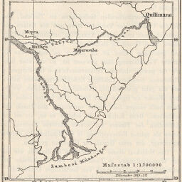
Skizze des Quaqua Flusses u. d. Zambesi-Mündungen
Permalink
https://digital.library.illinois.edu/items/36bab6f0-e946-0133-1d3d-0050569601ca-7
This item is in the public domain.
Descriptive Information
| Title | Skizze des Quaqua Flusses u. d. Zambesi-Mündungen |
| Creator | Petermann, A. (August), 1822-1878 |
| Date | 1889 |
| Dimensions | 9.2 x 8.5 cm |
| Place of Publication | Germany |
| Cartographic Scale | 1:1,700,000 |
| Coverage-Spatial | Luangwa River (Zambia and Mozambique) |
| Subject | |
| Genre | Maps |
| Language | German |
| Color | Bitonal |
| Technique | Lithography |
| Source | Petermanns geographische Mitteilungen, V. 35, p. 198. |
| Physical Location | stx |
| Map No. in Bassett and Scheven Bibliography | 1337 |
| Call Number | Q_910_5PE |
| Map ID | afm0001337 |
| Rights | No Copyright - United States |
| Rights Description | This item is in the public domain. |
| Collection Title | Maps of Africa to 1900 |
| Repository | Rare Book & Manuscript Library |
| Type | Cartographic material |
| Collection | Maps of Africa to 1900 |
Download Options
|
Skizze des Quaqua Flusses u. d. Zambesi-Mündungen |
Contact us
for questions and to provide feedback.