
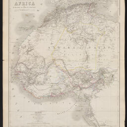
Das Norswestliche Africa
Permalink
https://digital.library.illinois.edu/items/36c978a0-e946-0133-1d3d-0050569601ca-c
This item is in the public domain.
Descriptive Information
| Title | Das Norswestliche Africa |
| Creator | Geographisches Institut (Weimar, Thuringia, Germany) |
| Date | 1866 |
| Dimensions | 64 x 52 cm |
| Cartographic Scale | 1:8,000,000 |
| Coverage-Spatial | Africa, North |
| Genre | Maps |
| Language | German |
| Source | Hand - Atlas Der Erde Und Des Himmels. Weimar, Germany. |
| Physical Location | Professor Thomas Bassett Personal Collection |
| Bibliography | Rumsey No., 2595.060 |
| Map ID | afm0003263 |
| Rights | No Copyright - United States |
| Rights Description | This item is in the public domain. |
| Collection Title | Maps of Africa to 1900 |
| Repository | Rare Book & Manuscript Library |
| Type | Cartographic material |
| Collection | Maps of Africa to 1900 |
Download Options
|
Das Norswestliche Africa |
Contact us
for questions and to provide feedback.