
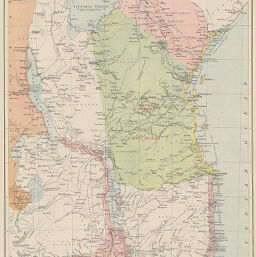
Eastern Central Africa: Showing Field of the Universities' Mission
Permalink
https://digital.library.illinois.edu/items/3704fb70-e946-0133-1d3d-0050569601ca-6
This item is in the public domain.
Descriptive Information
| Title | Eastern Central Africa: Showing Field of the Universities' Mission |
| Creator | Bartholomew, J. G. (John George), 1860-1920 |
| Date | 1866 |
| Dimensions | 44.8 x 28.9 cm |
| Place of Publication | Germany |
| Cartographic Scale | 1:5,600,000 |
| Coverage-Spatial | Africa, Eastern |
| Genre | Maps |
| Language | English |
| Color | Printed color |
| Technique | Lithography |
| Source | Meyer's Hand-Atlasder neuesten Erdbeschreibung in 100 Karten, between plates 89-90. |
| Physical Location | stx |
| Map No. in Bassett and Scheven Bibliography | 1123 |
| Call Number | F_912M575 |
| Map ID | afm0001123 |
| Rights | No Copyright - United States |
| Rights Description | This item is in the public domain. |
| Collection Title | Maps of Africa to 1900 |
| Repository | Rare Book & Manuscript Library |
| Type | Cartographic material |
| Collection | Maps of Africa to 1900 |
Download Options
|
Eastern Central Africa: Showing Field of the Universities' Mission |
Contact us
for questions and to provide feedback.